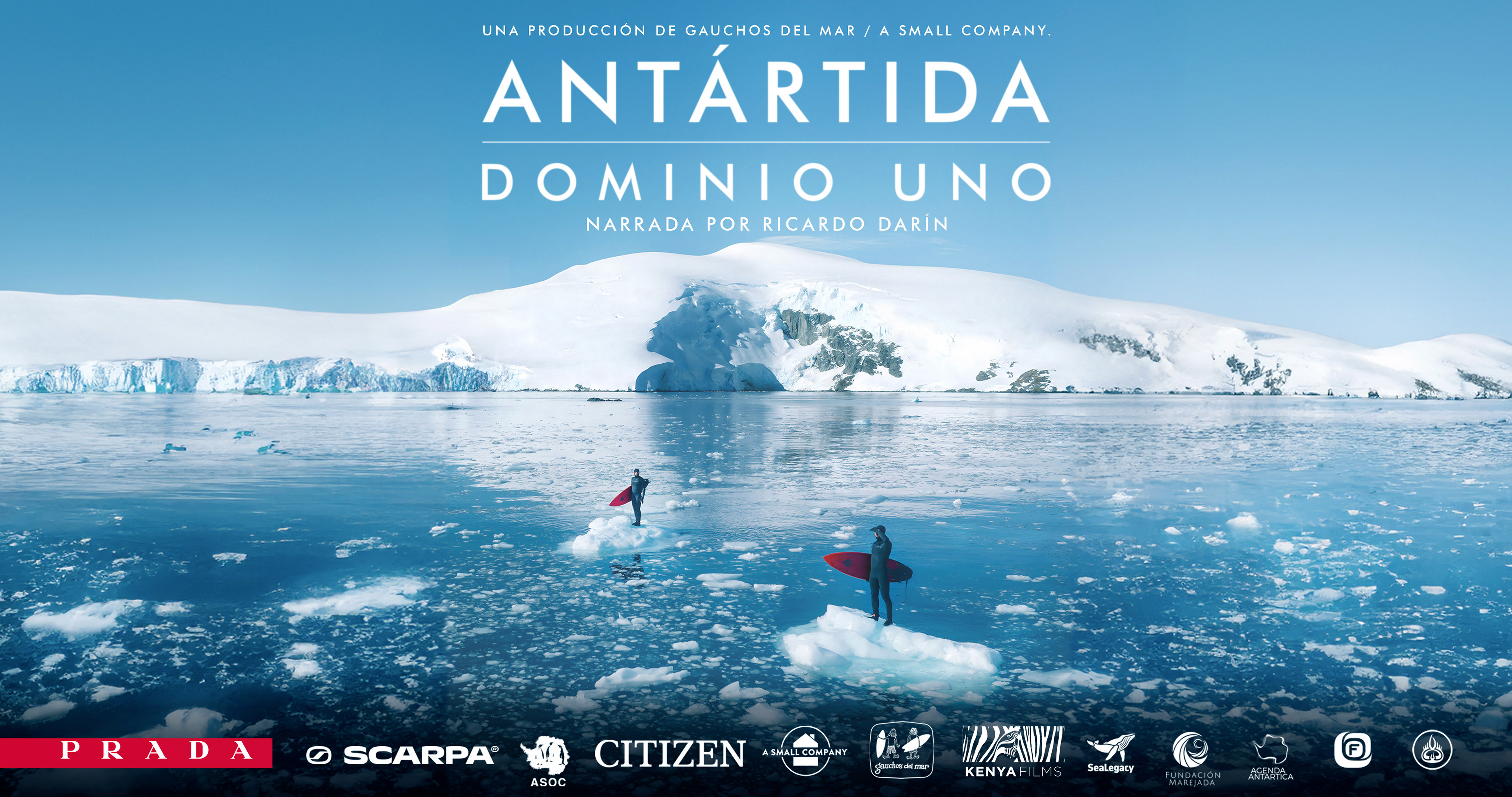
Antarctica, the white continent. Vast, wild but extremely fragile. The coldest place on our planet is also one of the most affected by global warming and needs to be protected.
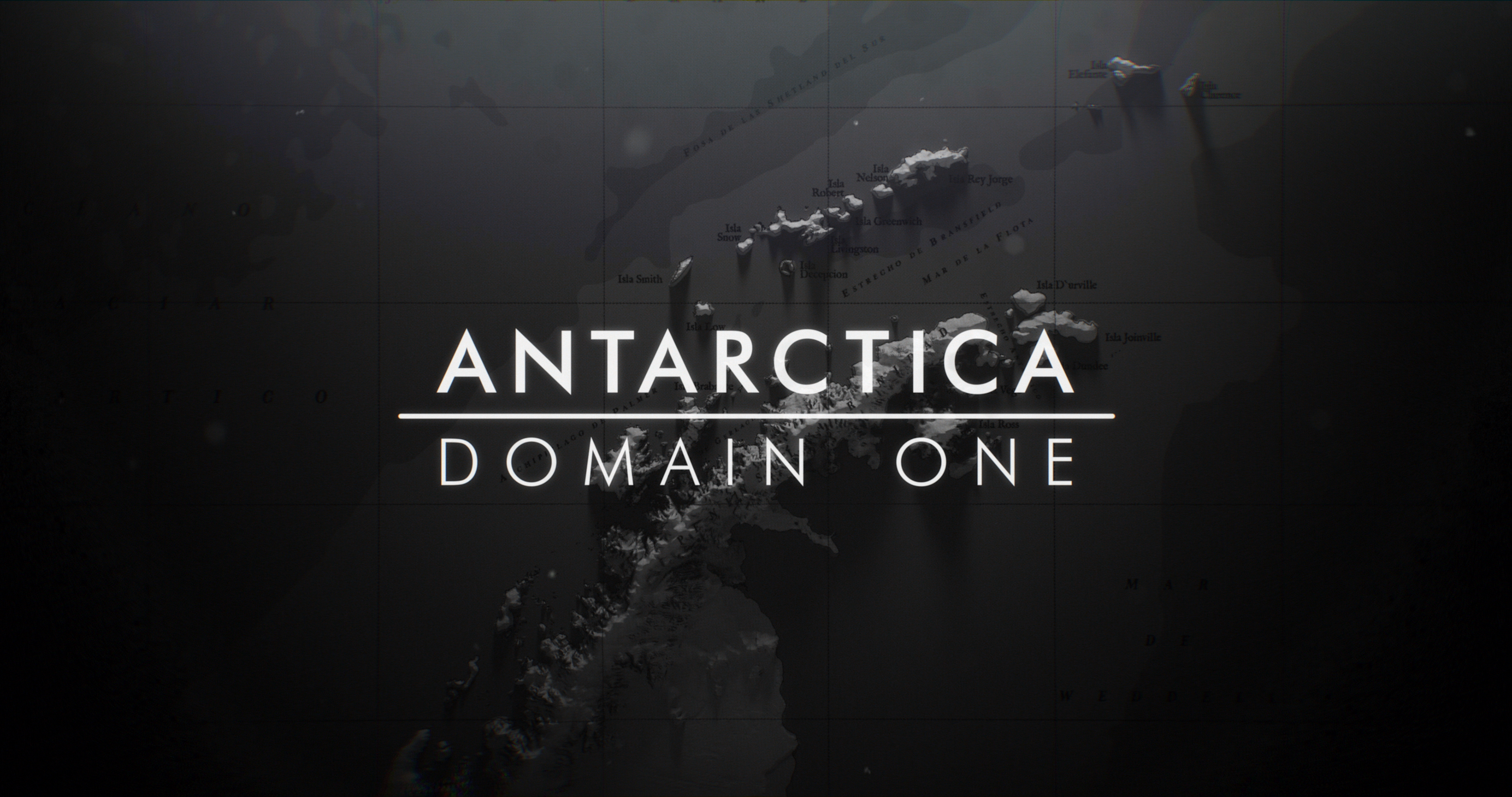
The expedition focuses on exploring, documenting and surfing the South Shetland Islands and the Antarctic Peninsula, specifically the area called Domain 1, which is promoted to be declared as a Protected Marine Area.
Protected areas are very important to mitigate climate change and in this case, to also regulate human activities such as concentrated fishing. This film will help to understand the importance of this area and the threats that affect this region. The film will also promote a petition to push the worldwide conservation of the area.
Antarctica is the only continent that belongs to humanity as a whole, and it’s our responsibility as inhabitants of this planet to take care of it.
Antártida, el continente blanco. Vasto, salvaje, pero extremadamente frágil. El lugar más frío de nuestro planeta es también uno de los más afectados por el calentamiento global y necesita ser protegido.
La expedición se centra en explorar, documentar y hacer surf en las Islas Shetland del Sur y la Península Antártica, específicamente en el área denominada Dominio 1, que se está promoviendo para ser declarada como Área Marina Protegida.
Las áreas protegidas son esenciales para mitigar el cambio climático y, en este caso, también para regular actividades humanas como la pesca intensiva. Esta película tiene como objetivo concienciar sobre la importancia de esta área y las amenazas que afectan a la región. Además, promoverá una petición para impulsar la conservación mundial del área.
La Antártida es el único continente que pertenece a toda la humanidad, y es nuestra responsabilidad, como habitantes de este planeta, cuidarlo.
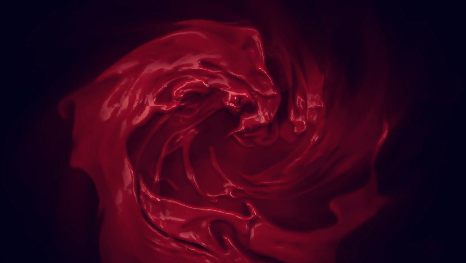
OPEN TITLES
HQ (Spanish Version)
OPEN TITLES
Sequence Edit (English Version)
MAPS
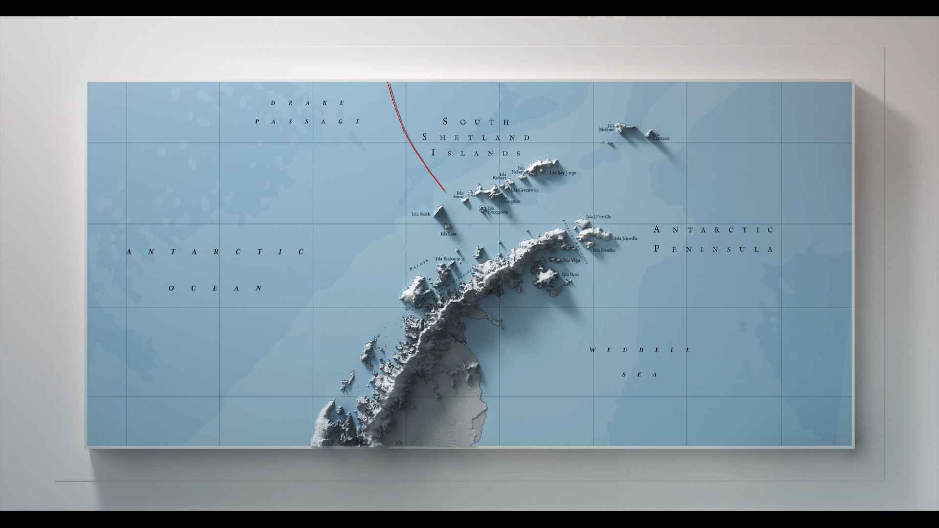
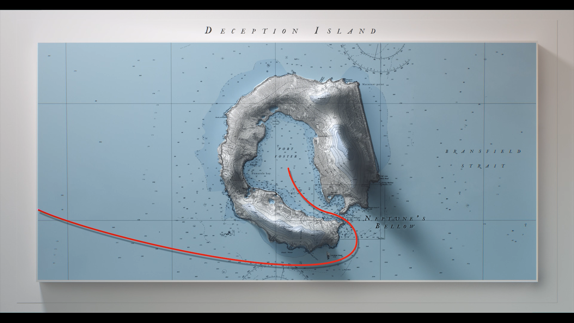
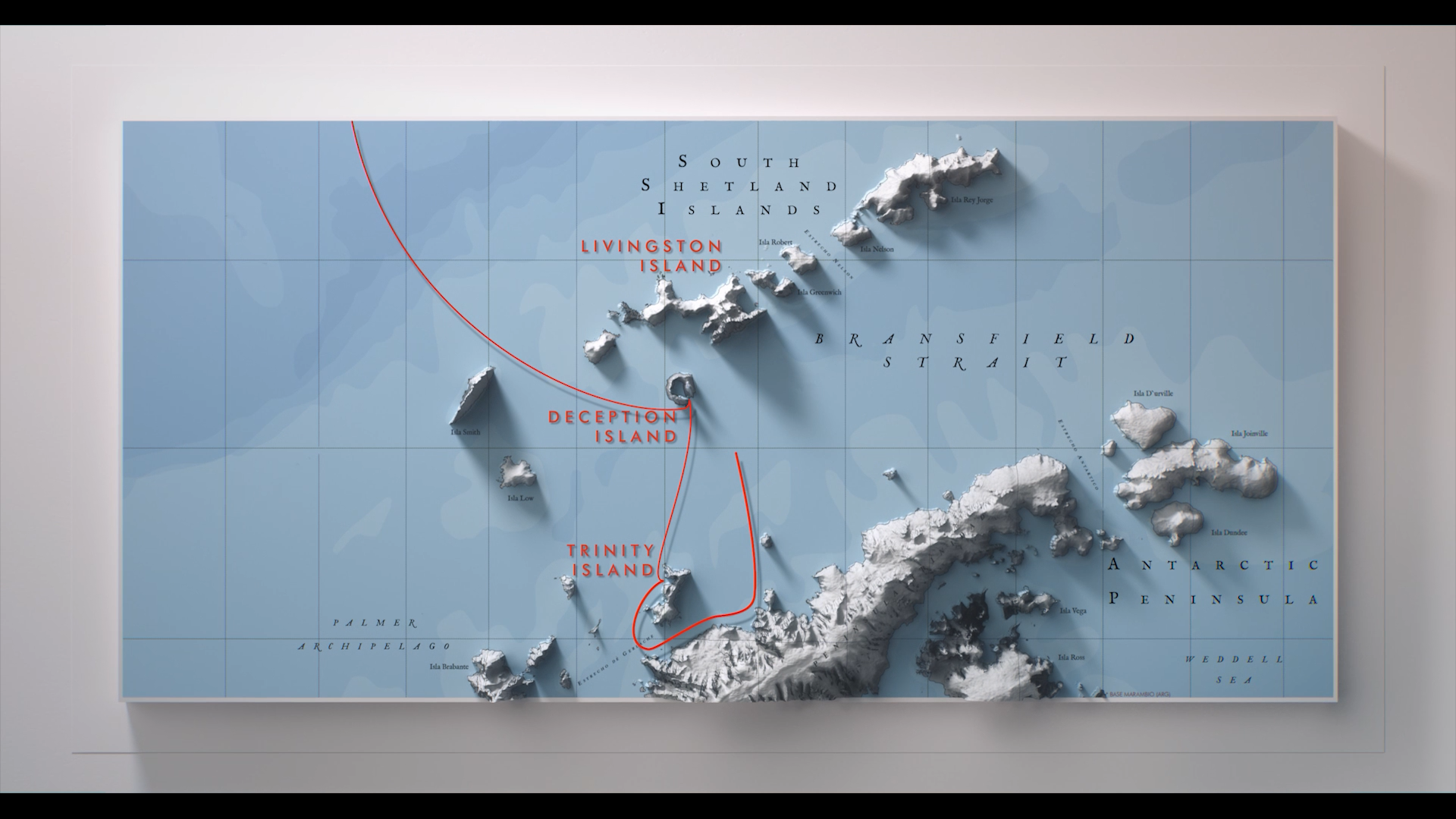
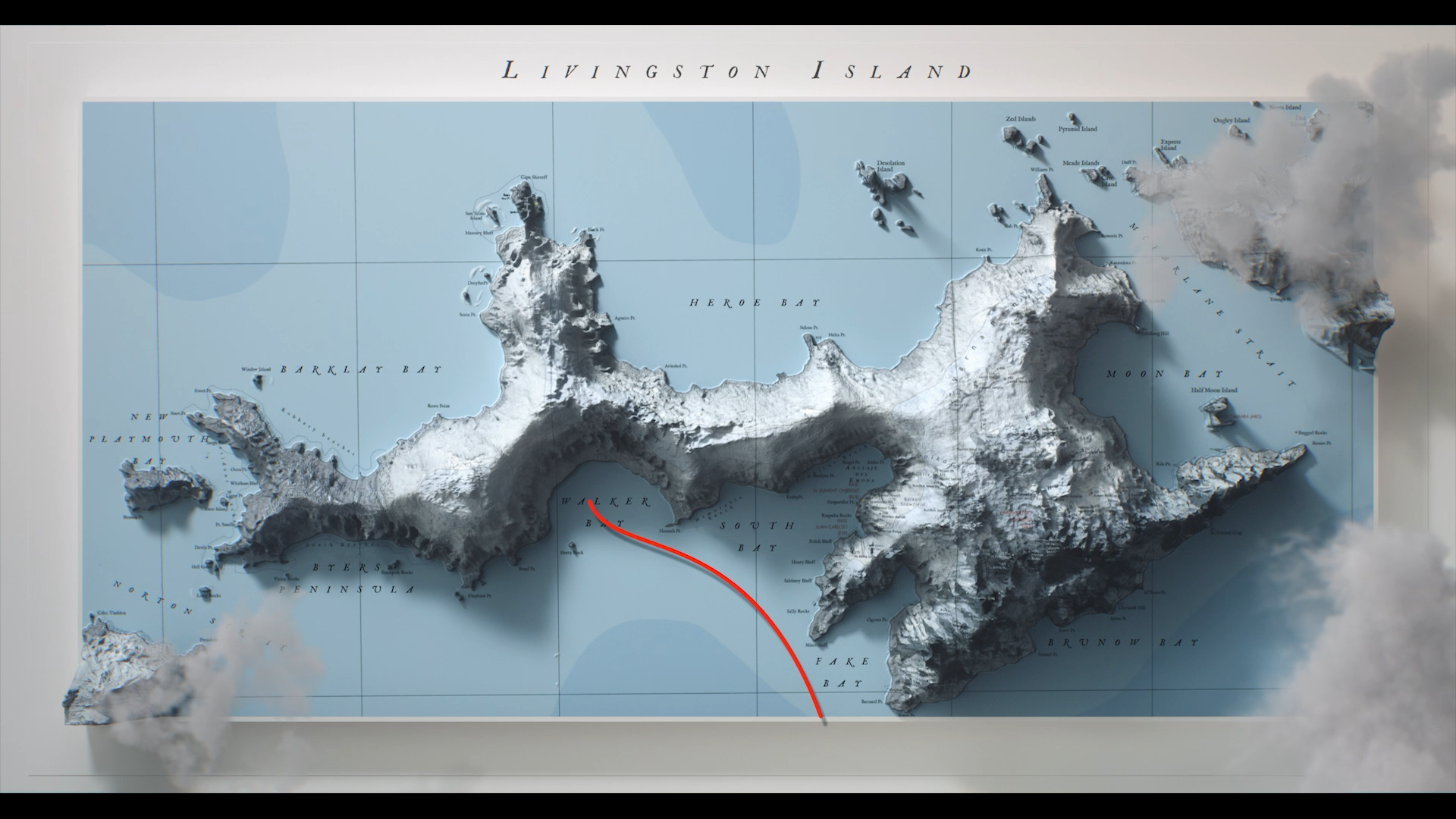
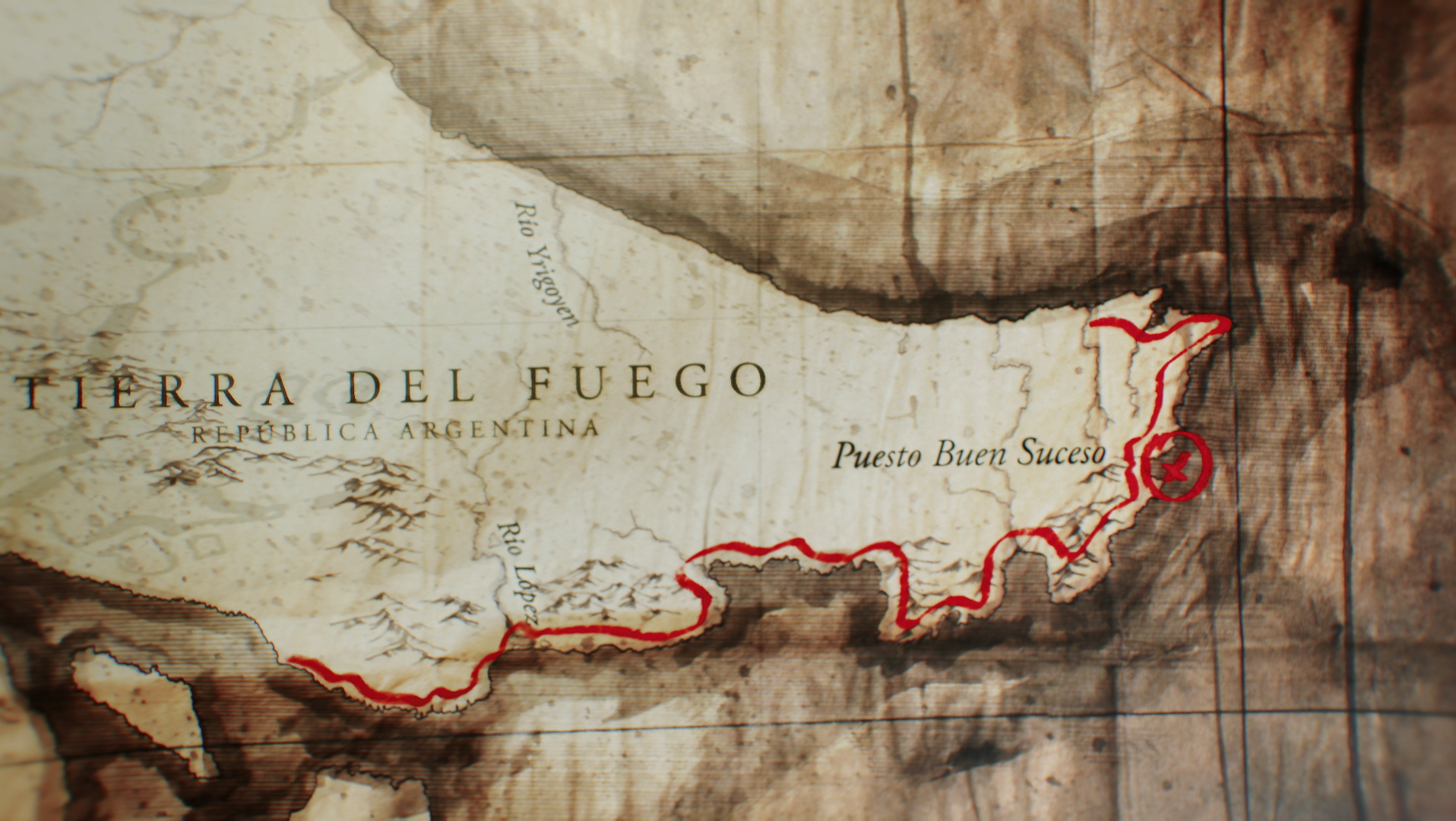
For the creation of the maps, we first organized how to represent the expedition route: different points, islands, seas, and currents, all unified under a single visual style. The process began with a preliminary edition of the locations to be featured.
Artistically, we aimed for a modern and contemporary style while also evoking the spirit of the great expeditions of past centuries—fearless explorers who gradually charted the coasts and boundaries of the White Continent without knowing what they would encounter.
Today, thanks to satellite technology and the continent’s scientific purpose, Antarctica is one of the best-mapped regions on Earth. However, this accuracy applies only to its continental mass. The islands and archipelagos of Dominion One—the maritime area surrounding the Antarctic Peninsula—have yet to be digitally mapped with complete accuracy. This led us to research extensively in archives of marine museums, as well as military, institutional, and commercial libraries, in order to decipher and define the islands represented in the documentary.
The maps were created digitally but crafted individually in an artisanal manner, carefully integrating information from diverse sources into a unified artistic language that embodies the spirit of the film.
Para la realización de los mapas, primero organizamos cómo mostrar la ruta de la expedición: distintos puntos, islas, mares y corrientes, todos unificados en un mismo estilo. Para ello desarrollamos una primera edición con los lugares a visitar.
En la etapa artística buscamos un estilo moderno y actual, pero que a la vez remitiera a las grandes expediciones de siglos pasados, a esos aventureros que se adentraban sin miedo en la zona más peligrosa del planeta, sin saber con qué se iban a encontrar, y que poco a poco fueron dibujando las costas y límites del continente blanco.
Hoy en día, gracias a la tecnología satelital y al carácter científico de la Antártida, se trata del continente mejor mapeado; sin embargo, esto aplica solo a su masa continental. Las islas y archipiélagos del Dominio Uno —la zona marítima que rodea la península antártica— no han sido aún cartografiados digitalmente de forma completamente precisa. Por este motivo, fue necesario investigar en archivos de museos marinos, hemerotecas militares, institucionales y comerciales, para poder definir y representar con fidelidad las islas que aparecerían en el documental.
Los mapas fueron realizados digitalmente pero trabajados de manera artesanal, uno por uno, integrando diversas fuentes de información y unificando todo en un mismo lenguaje artístico que representara el espíritu de la película.
FULL CREDITS SEQUENCES
(16mm plates and Rolling Credits)
Quiero agradecer a mi Familia, Barbara, Rochi y Jaz que se bancaron mis trasnochadas con el proyecto y luego a María Luz Riegelhaupt, por su sabiduría y buen gusto en el diseño del título y la definición de la paleta de colores de toda la pieza; a Agustina Tuduri, por su valiosa ayuda en la animación de elementos informativos utilizados en la película; y a Nicolás Villarejo, por su apoyo en los renders 3D. Todo mi cariño y gratitud para ellos.